Tuesday, April 09, 2013
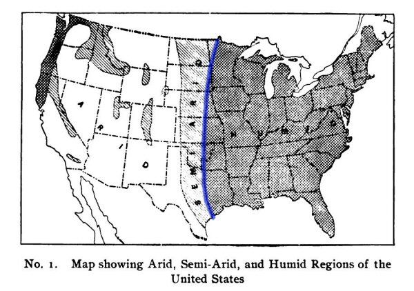
There's that Dry Line!
I've talked about the Dry Line a few times, but never found a map that shows it explicitly and correctly. Finally found one in a 1904 NatGeo:
 [Note the unfamiliar boundary between Okla Territory and Indian Territory; Okla didn't become a state until 1908.]
Dry Line divides East from West in land and plants and culture. West of Dry Line the land is dry and flat, the plants are sparse, and the people are laconic and private. East of Dry Line the land is hills and creeks and woods, and the people are noisy and intrusive.
[Note the unfamiliar boundary between Okla Territory and Indian Territory; Okla didn't become a state until 1908.]
Dry Line divides East from West in land and plants and culture. West of Dry Line the land is dry and flat, the plants are sparse, and the people are laconic and private. East of Dry Line the land is hills and creeks and woods, and the people are noisy and intrusive.Labels: Heimatkunde
