
Thursday, November 12, 2015
Eliza Paso
Since I'm pissing around with maps today, here's a Manhattan oddity.
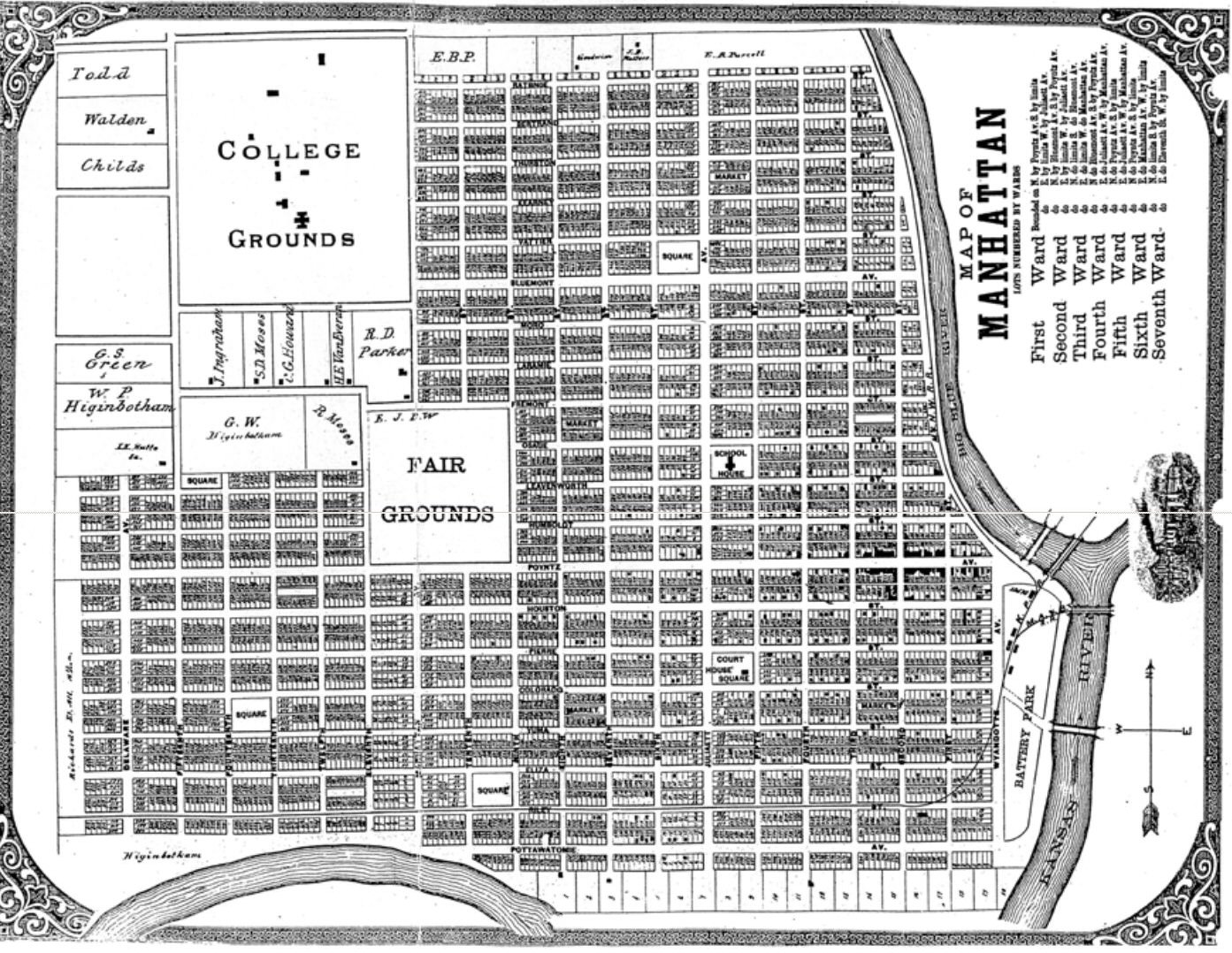
Found a nice 1885 townsite map contained in a PDF found here. The full map is too large to display on this page, so I stored it here.
One nice thing about the map is that it shows buildings. Not immediately obvious because it's not sharp, probably scanned and resized into the original PDF; but the blobs along Poyntz are clearly the correct shapes for business blocks, and blobs are scattered elsewhere in the patterns I'd expect for houses in that era. The oldest neighborhoods have more blobs. Note the house circled in blue at bottom. More about it later.
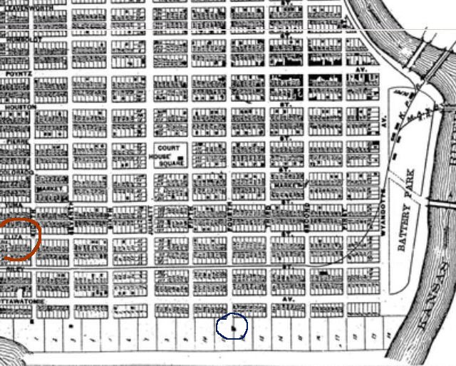 Another nice thing about the map: It shows where both the Kaw and the Blue ran before the 1903 flood. Both courses changed drastically. On this piece of the map you can see the Kaw pushing up toward the SW corner of town, then turning and running along the SE. The Blue ran directly along the E side. After 1903, the Kaw moved south, letting Wildcat Creek take the former riverbed along the S side. This formed Hunter's Island, which wasn't exactly an island. The Blue moved about a mile east, leaving a floodplain that wasn't settled until 1970 or so.
But what I'm really noticing on this map is Eliza Street, circled in red. Eliza soon became El Paso, and soon acquired a railroad down its middle just as Riley St already had. After 1900, El Paso and Riley were nominally streets but actually railroads. Only El Paso had houses and sidewalks facing the railroad; Riley had houses that more honestly faced the drivable alleys. Now I know why El Paso had those strangely faced houses! It began as a real drivable street with a different name.
It's possible that Eliza was simply a mapmaker error, like Rustic St in Spokane. All the other horizontal streets are named after locations or 'founders', with the partial exception of Poyntz, named after Col John Poyntz, a relative of one of the early land-sellers, thus probably an investor.
= = = = =
Aug 2017 update: The original of the Eliza map is page 72 of an atlas at KSHS. Much clearer image than the scanned scan above. The mapmaker made two other odd errors. Ratone St becomes RATBNOE, Tenth is TENTENTH. So it's RATBNIOAL to ASSUSSUME that ELIZA is just a misread.
Another nice thing about the map: It shows where both the Kaw and the Blue ran before the 1903 flood. Both courses changed drastically. On this piece of the map you can see the Kaw pushing up toward the SW corner of town, then turning and running along the SE. The Blue ran directly along the E side. After 1903, the Kaw moved south, letting Wildcat Creek take the former riverbed along the S side. This formed Hunter's Island, which wasn't exactly an island. The Blue moved about a mile east, leaving a floodplain that wasn't settled until 1970 or so.
But what I'm really noticing on this map is Eliza Street, circled in red. Eliza soon became El Paso, and soon acquired a railroad down its middle just as Riley St already had. After 1900, El Paso and Riley were nominally streets but actually railroads. Only El Paso had houses and sidewalks facing the railroad; Riley had houses that more honestly faced the drivable alleys. Now I know why El Paso had those strangely faced houses! It began as a real drivable street with a different name.
It's possible that Eliza was simply a mapmaker error, like Rustic St in Spokane. All the other horizontal streets are named after locations or 'founders', with the partial exception of Poyntz, named after Col John Poyntz, a relative of one of the early land-sellers, thus probably an investor.
= = = = =
Aug 2017 update: The original of the Eliza map is page 72 of an atlas at KSHS. Much clearer image than the scanned scan above. The mapmaker made two other odd errors. Ratone St becomes RATBNOE, Tenth is TENTENTH. So it's RATBNIOAL to ASSUSSUME that ELIZA is just a misread. 

Another nice thing about the map: It shows where both the Kaw and the Blue ran before the 1903 flood. Both courses changed drastically. On this piece of the map you can see the Kaw pushing up toward the SW corner of town, then turning and running along the SE. The Blue ran directly along the E side. After 1903, the Kaw moved south, letting Wildcat Creek take the former riverbed along the S side. This formed Hunter's Island, which wasn't exactly an island. The Blue moved about a mile east, leaving a floodplain that wasn't settled until 1970 or so.
But what I'm really noticing on this map is Eliza Street, circled in red. Eliza soon became El Paso, and soon acquired a railroad down its middle just as Riley St already had. After 1900, El Paso and Riley were nominally streets but actually railroads. Only El Paso had houses and sidewalks facing the railroad; Riley had houses that more honestly faced the drivable alleys. Now I know why El Paso had those strangely faced houses! It began as a real drivable street with a different name.
It's possible that Eliza was simply a mapmaker error, like Rustic St in Spokane. All the other horizontal streets are named after locations or 'founders', with the partial exception of Poyntz, named after Col John Poyntz, a relative of one of the early land-sellers, thus probably an investor.
= = = = =
Aug 2017 update: The original of the Eliza map is page 72 of an atlas at KSHS. Much clearer image than the scanned scan above. The mapmaker made two other odd errors. Ratone St becomes RATBNOE, Tenth is TENTENTH. So it's RATBNIOAL to ASSUSSUME that ELIZA is just a misread. Labels: new toy
¶ 10:52 AM