Tuesday, September 08, 2015
Rustic or Rustle?
I finally bought and downloaded an old map of Spokane. The free online views were just enough to be tantalizing but not enough to settle some questions. Both questions turn out to be similarly-formed errors by the mapmaker. A 1912 version of DYAC.
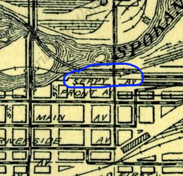
First, an odd one. Serpy Avenue! This may never have been a drivable street; it was inside the old useful industrial riverside that was torn out and replaced by green useless shit to satisfy Comrade Nixon's Gaian vision for Expo 74. I wish someone had re-used the wonderful name. It really belongs on a twisty turny street, not a simple straight block.
 Checking: The 1930s map bundled with the 1940 Census shows this as Ferry St, which makes complete sense for the riverfront location. Serpy must be a misread of partly-erased Ferry. You can see the top bit of the F that turned into S. It's still a wonderful name. You can't say it without smiling.
= = = = =
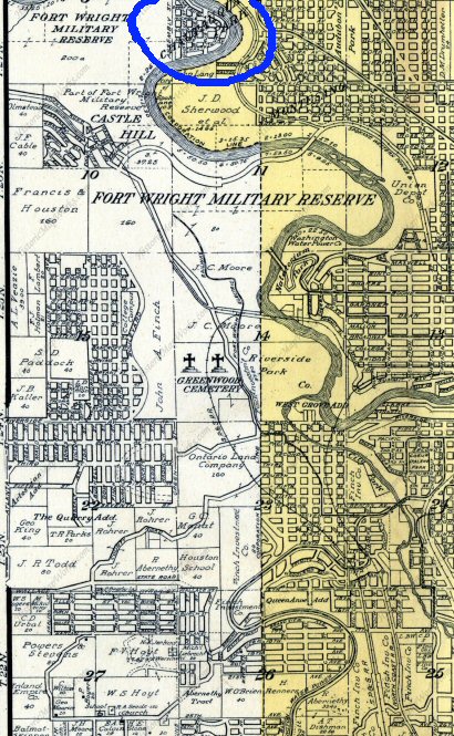
The map shows a whole shitload of urban-looking subdivisions west of the river. Very few of those plats ever got built. The land was too vertical for proper development, and the river was too hard to bridge. At the north end of this segment is the imaginary Chautauqua Park, which is roughly under TJ Meenach Bridge now. Chautauqua Park did serve one purpose: it created some street names that carried on into real developments.
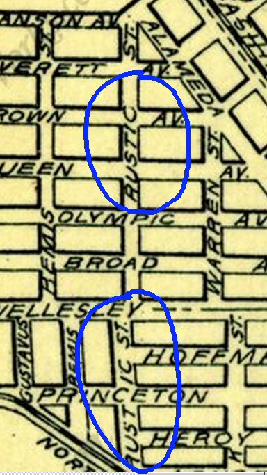
 One of those names was Rustic. Or so this mapmaker thought. He carried Rustic up into my neighborhood:
 This was a puzzle because the street is currently named Rustle. I thought at first that Rustle was the mistaken version, preserved through the years, because Rustic seems like a more natural street name.
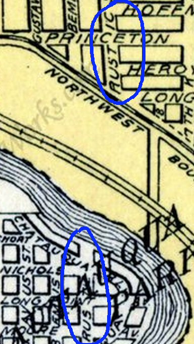
But the hi-res version of the map solves the puzzle.
 By comparing with other letters you can see that the original name in the imaginary Chautauqua Park WAS Rustle. The big letters for Chautauqua Park partly obscured TLE, leading the cartographer to decide that it must be the 'more natural' Rustic.
 Checking: The 1930s map bundled with the 1940 Census shows this as Ferry St, which makes complete sense for the riverfront location. Serpy must be a misread of partly-erased Ferry. You can see the top bit of the F that turned into S. It's still a wonderful name. You can't say it without smiling.
= = = = =
The map shows a whole shitload of urban-looking subdivisions west of the river. Very few of those plats ever got built. The land was too vertical for proper development, and the river was too hard to bridge. At the north end of this segment is the imaginary Chautauqua Park, which is roughly under TJ Meenach Bridge now. Chautauqua Park did serve one purpose: it created some street names that carried on into real developments.
 One of those names was Rustic. Or so this mapmaker thought. He carried Rustic up into my neighborhood:
 This was a puzzle because the street is currently named Rustle. I thought at first that Rustle was the mistaken version, preserved through the years, because Rustic seems like a more natural street name.
But the hi-res version of the map solves the puzzle.
 By comparing with other letters you can see that the original name in the imaginary Chautauqua Park WAS Rustle. The big letters for Chautauqua Park partly obscured TLE, leading the cartographer to decide that it must be the 'more natural' Rustic.
Labels: Heimatkunde
