Friday, January 13, 2017
Urban cold island?
Weather Underground's temperature map is an excellent piece of graphics. The colors themselves and the 'deadbands' for shading are well-chosen. You can tell at a glance where the hot and cold areas are.
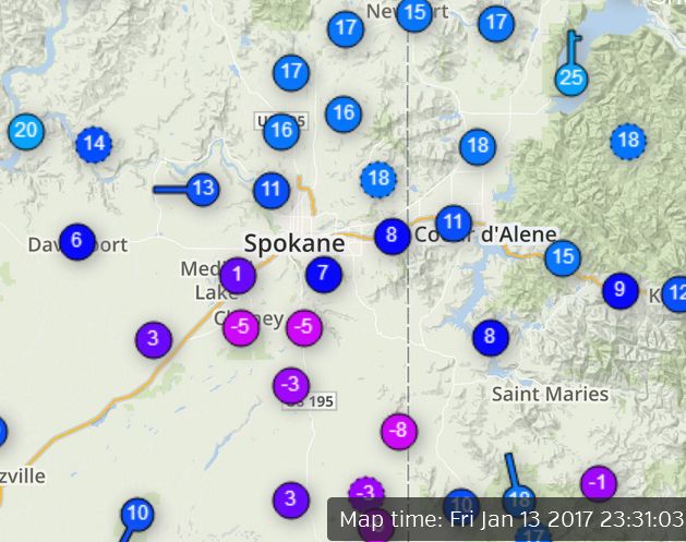
 An unusual pattern shows up just now. Normally supercold comes from the N or NE here, as Arctic air either comes straight down from BC or jumps the Rockies from Montana. Normally the urban area retains heat better than rural. Today it's reversed. Looks like a warm area to the north and a cold spot covering Spokane County. From -5 at Spangle to 17 at Mead = 22 degrees in 22 miles. Most likely a difference in cloudiness, but it's a notably SHARP and contrary gradient.
 An unusual pattern shows up just now. Normally supercold comes from the N or NE here, as Arctic air either comes straight down from BC or jumps the Rockies from Montana. Normally the urban area retains heat better than rural. Today it's reversed. Looks like a warm area to the north and a cold spot covering Spokane County. From -5 at Spangle to 17 at Mead = 22 degrees in 22 miles. Most likely a difference in cloudiness, but it's a notably SHARP and contrary gradient.
